News
Firma NaviGate Wystawcą International Droen Event.
NaviGate joins the International Drone Event
08 july 2022
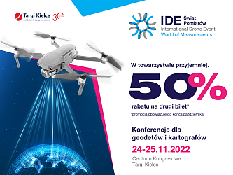
IDE the World of Measurements is an event which makes it possible to learn about the latest measurement solutions for geodesy offered by NaviGate from Krakow. The company's offer will be presented on 24 and 25 November 2022 at the Targi Kielce Congress Centre.
The November drone meeting at the Targi Kielce Congress Center welcomes NaviGate with its latest, advanced measurement solutions for geodesy:
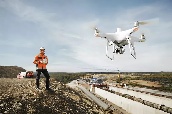
- DJI Enterprise unmanned aerial vehicles (drones) for photogrammetry and geodesy
- DJI Enterprise drone sensors
- MicaSense multispectral cameras
- SHARE multi-lens cameras for geodetic measurements without the use of GCP Ground Control Points
- FLIR thermal imaging cameras
- CHC LiDAR scanners for precise 3D laser scanning
- data processing software Pix4Dmapper, DJI Terra, 3Dsurvey, TerraSolid. The NaviGate stand you offers the chance to test all software free of charge
- viDoc RTK rover for RTK-accurate 3D model acquisition
- robotic total station and geodesic receivers by Spectra Geospatial (Trimble) and Carlson.
A team of NaviGate experts will help you find the best equipment and identify solutions that create new opportunities in surveying.
We look forward to seeing you on 24 and 25 November 2022 at the Targi Kielce Congress Centre! We encourage you to participate in the conference - prior registration required
(MCh)
Recommended articles
25 november 2022
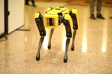
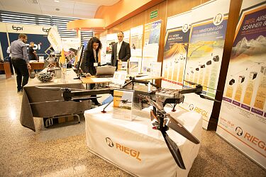
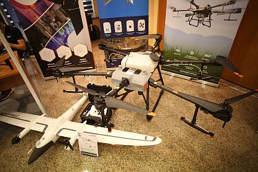
The SARUAV system from AeroMind is used in missing people search, Spot from Geotronics Dystrybucja - the dog-robot proves useful in measurements, the latest drone models used in geodesy and agriculture from TPI, the 3D laser mapping technology from RIEGL/Laser 3D.pl and the latest and most advanced solutions UAVs available on the market from NaviGate - Drone Center. These are only some of the technologies on show at the IDE- the World Measurements conference and exhibition.
24 november 2022
Geodetic works, design and public consultations, scanning systems and the legal aspect of the use of drones - the International Drone Event - the World of Measurements in Targi Kielce cast some light on using drones for entertainment and map creation.
24 november 2022
Flight safety supervision, search for missing persons, photogrammetric and multispectral measurements, live streaming from UAV - these are some of the applications of unmanned aerial vehicles presented during the IDE-World of Measurements conference at the Targi Kielce Congress Centre!

17 november 2022
Modern drone techniques are also used in agriculture and forestry. 24 November sees dedicated discussions at the IDE-World of Measurements conference at the Targi Kielce Congress Centre

15 november 2022
The IDE- World of Measurements conference and exhibition - 24 and 25 November 2022 at the Targi Kielce Congress Centre. The event features NaviGate presenting the latest and most advanced UAV solutions available on the market

09 november 2022
The dynamic development of the uncrewed aerial vehicle (UAV) sector spurs the introduction of a solution enabling electronic coordination of drone flights and management of their movement in public space. These issues are discussed during the IDE-world of Measurements conference held on 24 and 25 November at the Targi Kielce Congress Centre
08 november 2022
Geotronics Distribution discusses autonomous drones flights in all conditions. The IDE presentations
"Autonomous drones flights in all conditions. A revolution in measurements technologies - the Emesent Hovermap ST scanner in use". This is the lecture title delivered by MSc. Wojciech Stolarski from Geotronics Distribution.
24 october 2022
Tickets for the International Drone Event - World of Measurement conference can be purchased at a promotional price until the end of October. We look forward to seeing you on 24 and 25 November 2022 at the Targi Kielce Congress Centre!